
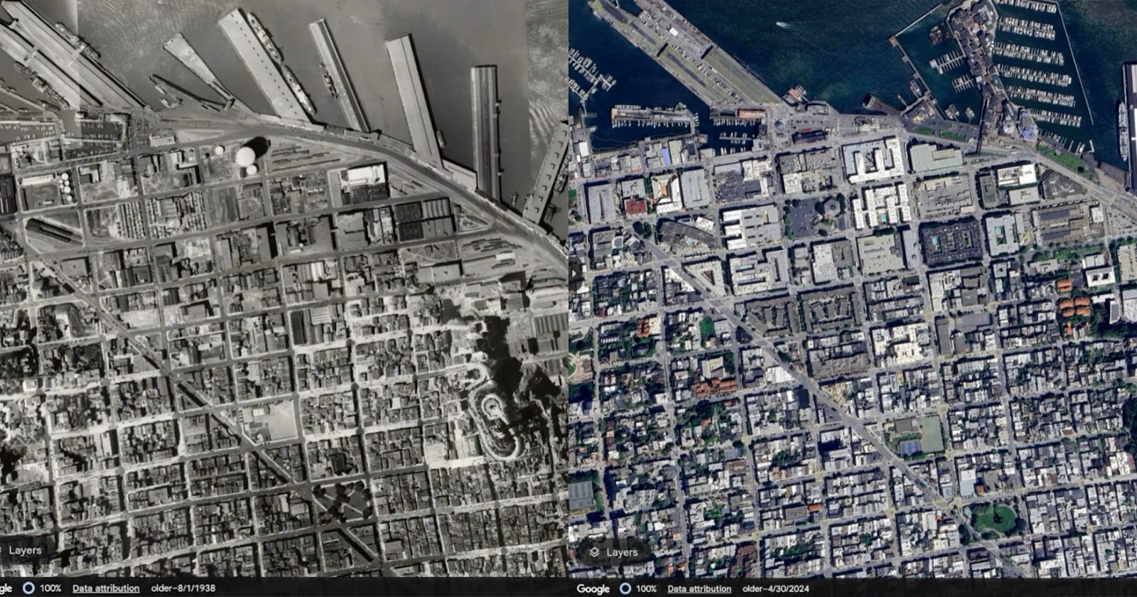
Google has introduced historical Street View imagery to Google Earth, allowing users to view how places have changed over time at street level—not just from satellite bird’s-eye views. Previously, this feature was exclusive to Google Maps, but now Google Earth users on both web and mobile can “explore from even more viewpoints” to time-travel across decades.
This update marks the 20th anniversary of Google Earth, first launched in 2005. The platform achieved 100 million downloads within its first week, and in the past year alone, users performed more than 2 billion place searches—a testament to its enduring popularity.
A Twitter trend last year encouraged people to virtually revisit their childhood neighborhoods. In response, Google extended this nostalgia-fueled tool into Earth, enabling urban explorers to witness the evolution of their own streets. “You can explore the wonders of the planet from even more viewpoints, whether it’s a bird’s eye view or at street level,” said Yael Maguire, VP & GM of Google Maps Platform & Google Earth.
In addition to historical imagery, Google Earth will soon offer AI-powered data insights for professional users in the U.S., including tree canopy coverage and land surface temperature maps. These insights help planners identify shaded areas and urban heat zones. The company says these new data layers will roll out “in the coming weeks.”
Google also continues to enhance coverage: Street View has expanded across nearly 80 countries, driven by a more portable camera introduced in 2022—light enough to be mounted on any vehicle. Complementing that is an AI-powered Cloud Score+ tool that removes clouds and enhances satellite imagery, resulting in “brighter, more vibrant” visuals.